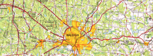
This map explorer, designed by the U.S. Geological Survey, overlays years worth of digitized historical topographic maps onto a neutral basemap of the United States. This map is very clear and user friendly ⎯ simply type in a U.S. location, and then click a place on the map to see what historic maps are available in the area. Once zoomed in at a city-level, the site provides a timeline of the historic maps produced around that location, some dating back to the late-1800s. Each map provided in the timeline is available to view and play with.

You must be logged in to post a comment.