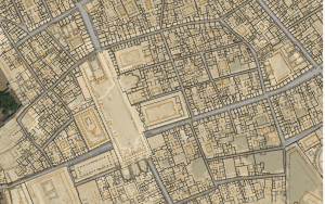
The Pompeii Bibliography and Mapping Project uses writings about the ancient city to create a map that reflects the city’s original layout. Using ArcGIS, this project provides a new way to engage with detailed information provided by numerous publications on Pompeii. In addition to providing visualizations of all the data, the project makes all core data available for download and later use. The map’s layers provide illustrative details about the city’s design, including elevation points, building functions, and curbstone materials.

You must be logged in to post a comment.